Revolutionary War Era Naval Battle Sketch and Maps Showcase Poster Print
- Heavy Poster Stock Print
- Approximately 13 X 19 inches
-
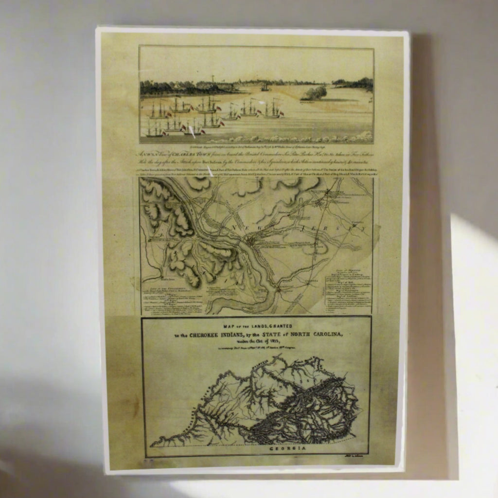
Here we have a small showcase of sketched art and maps from the Revolutionary War era from the holdings of the National Archives. Shown are 2 excerpts from the Atlas of Battles of the American Revolution. On the top is a view of Charles Town from onboard the Bristol under Commodore Sir Peter Parker's command in 1776. The sketch of the battle in Five Fathom Hole the day after the Attack upon Fort Sulivan by the Commodore & his Squadron, which Action continued 9 hours & 40 minutes. The British were unsuccessful in capturing the fort. However, they were successful later in 1780 as part of the Siege of Charleston. At the time Fort Sullivan was also known as Fort Moultrie.
In the center is the Plan of the Operations of General Washington against the King's Troops in New Jersey. from the 26th of December 1776 to the 3rd of January 1777 by William Faden.
The item at the bottom is a Map of Lands Granted to the Cherokee Indians by the State of North Carolina under the Act of 1783. The map is not from the same publication; the original was created in 1783.
-
The holdings of the Cartographic and Architectural Section of the National Archives include over 15 million maps, charts, aerial photographs, architectural drawings, patents, and ship plans, constituting one of the world's largest accumulations of such documents.