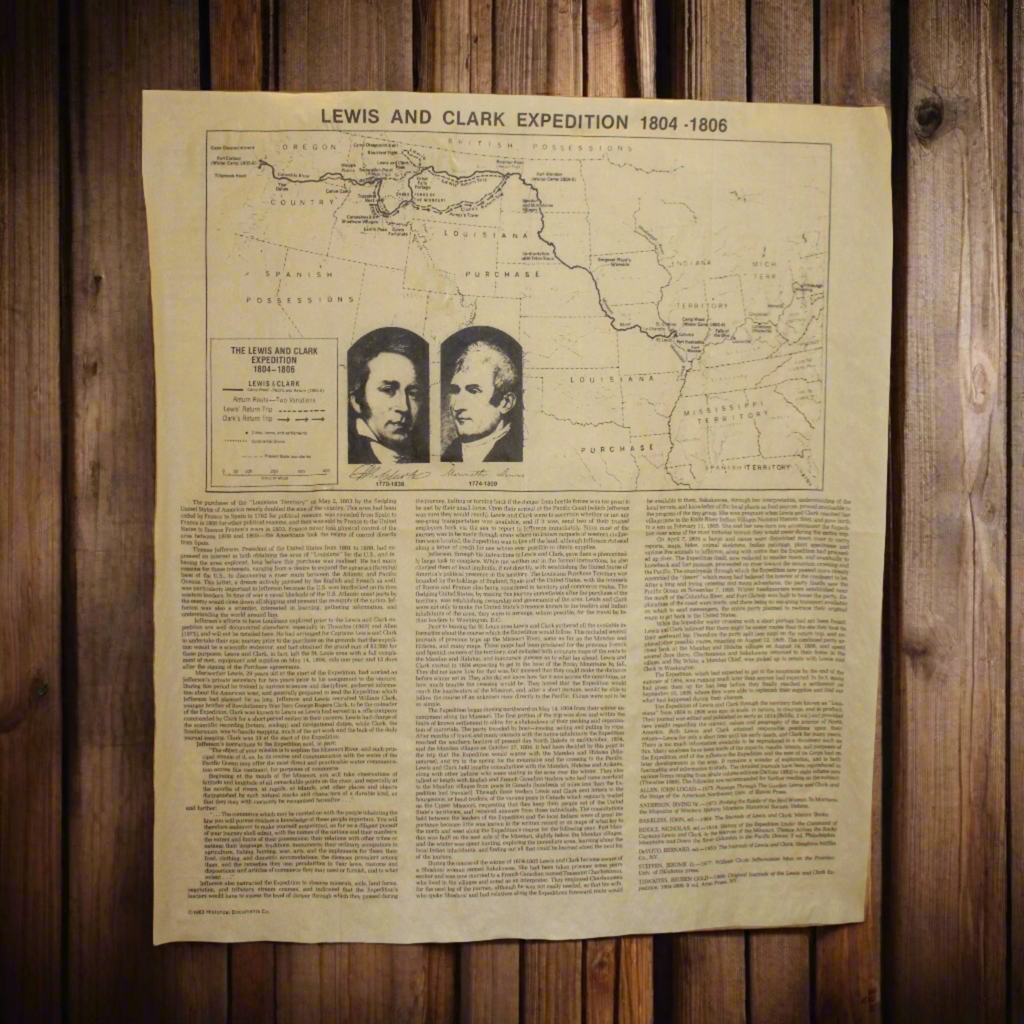
Lewis & Clark's Expedition Map
- Made in the U.S.A.
- Printed on antiqued parchment paper
- Approximately 14 x 16 inches
-
It's 1803, and two adventurous young army officers are about to lead an expedition right across the North American continent, through the Rocky Mountains to the Pacific Ocean. They will explore lands that few Europeans have ever seen and will make many scientific discoveries. Perhaps the greatest and most famous transcontinental adventure in American history, the expedition of Lewis and Clark from 1804-1806 is encapsulated in this document featuring a map, the photographs and signatures of the venture's leaders, and explanatory text. Inspired by Thomas Jefferson and carried out by these two brave men and their crew, the Lewis and Clark Expedition opened up the west for America.